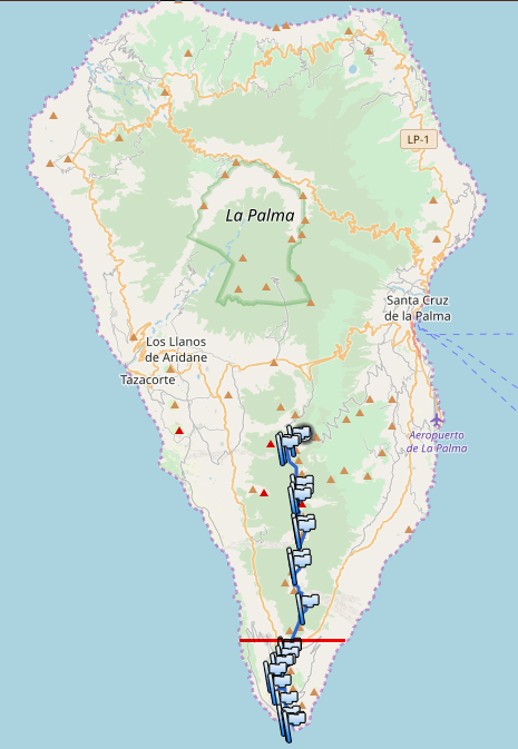
Ruta de los vulcanes
La Palma is the paradise on Earth. This island will charm the heart of every nature lover!
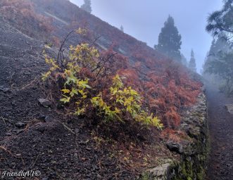
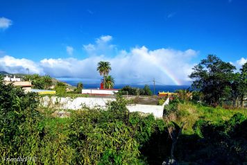
An incredibly lush island that has it all: mysterious beaches of black sand, amazing night sky due to their yellow light policy and very little light at night in general, lush vegetation with the exotic “drago” trees, and platanos plantations at every step (the best banana you will ever eat), friendly lizards, and a sun that always comes out, even if it is a cloudy day.
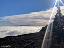
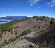
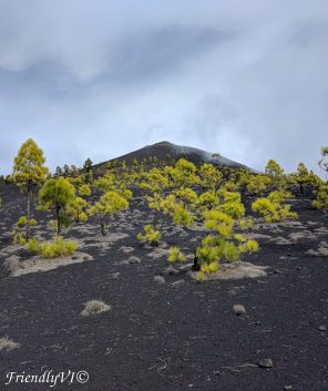
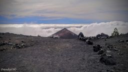
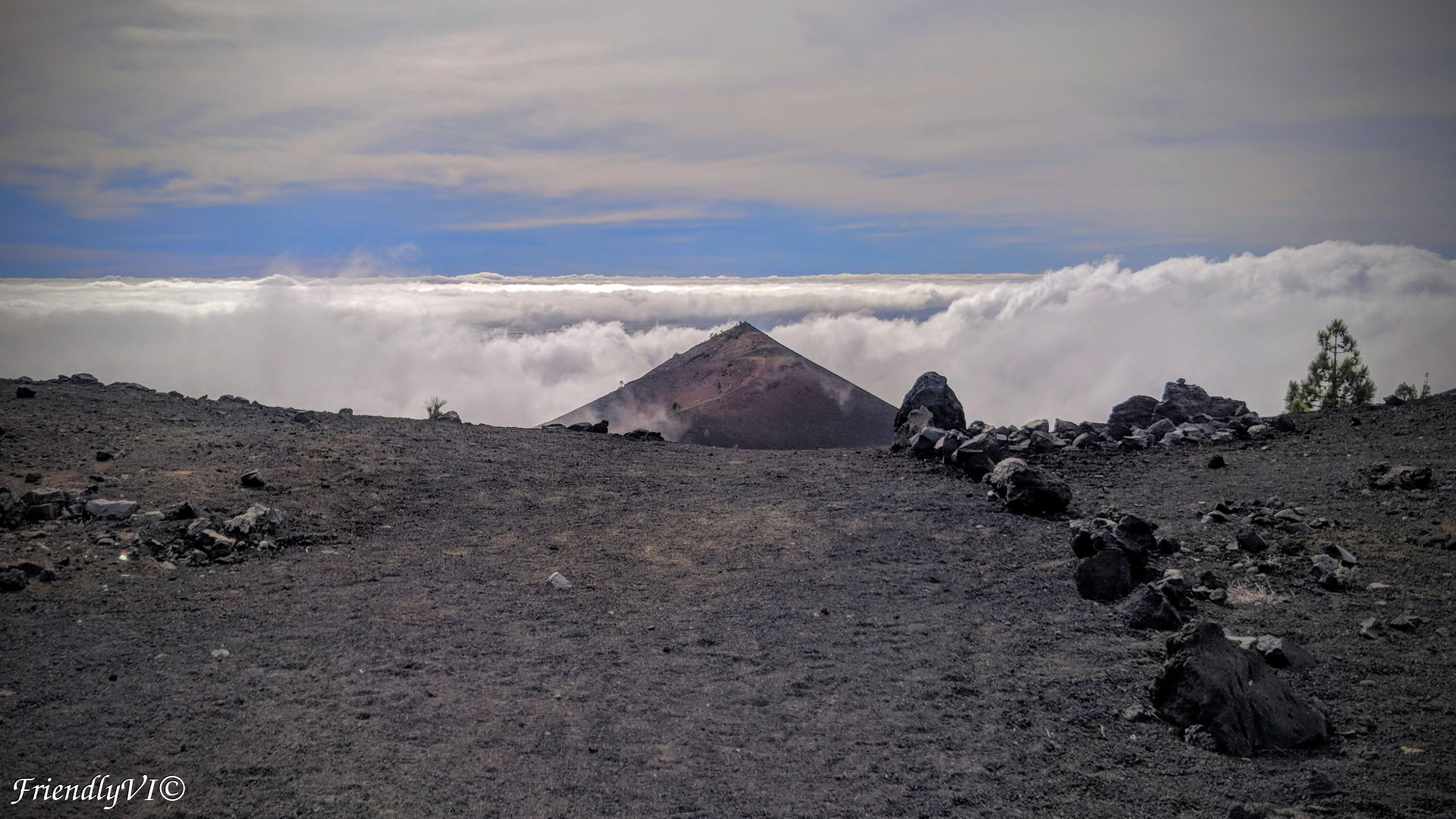
All its lushness is complemented by the volcano region of the island, which transposes you in a completely different universe. The feeling during the hike is really indescribable, the wind sounds different, the sun feels different, the colors are like in no other hike you ever took. Here is my take on the “Ruta de los volcanes”:
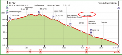
- Distance: 17.4 km
- Starting point: Refugio el Pilar
- Starting time: 8:50 am
- Ending point: Fuencaliente (not Faro de Fuencaliente which is a 23.7 km route)
- Ending time: 3:07 pm
- Total hiking time: 6h 17 min
- Time of the year for this trip: December
Start: A very important thing to mark is that there are no buses that can bring you there and the car is not an option, since this is not a circular route. We booked a taxi the day before that took us from our Airbnb close to Santa Cruz de la Palma to Refugio el Pilar for something around 15-20 eur. The taxi driver was very punctual and friendly and he knew exactly where the route starts, but it is very easy to find it on Google maps.
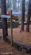
Difficulty: The trail is marked on Senderos de la Palma as high. For the only 17.4 km we walked, I would only categorize it as medium. We are fit people, but not very trained hikers. The route doesn’t present any dangerous parts, no gullies on the way, no exposed paths. However, the terrain is very sandy and slippery at parts, but the main difference is that it affects traction of the shoes and it is a bit slower to walk, the wind can be quite strong on the top of the volcanoes and the route feels quite long. The route is frequented, you will meet people from time to time, so this makes it even safer from my point of view. The trail is well marked and the path is very clear so there was not a single time when we were confused.
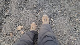
Equipment: The hike started for us in a very thick fog and quite a bit of water got accumulated on our clothes. It is recommended to wear waterproof jacket and pants and a buff on the head. The pants should preferably go over your shoes, otherwise you will need to clean the sand and rocks in the shoes every ten meters. Good trekking shoes higher than your ankles are recommended. The buff or a head cover will be good to protect you against potential fog in the forest and very strong sun on the top of the volcanoes. In addition to a head cover, bringing sunglasses will be very useful both for dust and strong sun. For ladies I would recommend a warm thick sport bra to protect you well from the strong wind in some of the parts. Extra battery for the phone and a Swiss army knife are always there for any trip. Last, but not least, the UV is strong at the lunch time even in December, so make sure you use sun protection!
Fueling: We chose an easy pace since we had all day and spent 6 hours on the route. It is compulsory to bring water, since there are no water springs on the way. Two sandwiches with butter, ham and cheese and separate cherry tomatoes, peppers and olives will be just fine for this trip. Bring a sweet bar (or few) both as a treat for the the trip but also as an emergency food in case you run low on sugar if your pace is more intense.
End: We did not choose the complete route of the volcanoes, which goes until Faro de Fuencaliente. We decided that until Los Canarios will be good enough so that our legs won’t be that sore on New Year’s Eve. In order to get back to your accommodation you can use again a taxi or a cheaper version: the bus.
On the official website for transportation in La Palma (http://www.transporteslapalma.com) you can find the connection you need. But Google maps is a lot more capable and will find the 201 bus connection to Santa Cruz de la Palma and the schedule in no time, as well as where the stations are.
Sources: La Palma has amazing foot paths. They have a very detailed website that I encourage you to use, all the information is present there, maps, difficulty of the routes, recommended times of the year for each trail and basic recommendations: http://www.senderosdelapalma.es/en/.